Manitoulin Island in Lake Huron offers a unique cultural experience as well as plenty of natural features to attract the adventurous visitor.
Despite being the largest freshwater island in the world, Manitoulin has a population of only 13,000 inhabitants. Those who call the island home include six First Nations communities
Manitoulin Island lies just off the coast of Ontario and is separated from the mainland by the North Channel.
Georgian Bay is to the east of the island while the major part of Lake Huron is situated to the south and west.
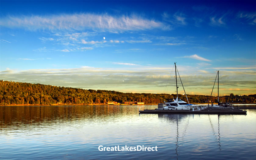
Sunset on Manitoulin Island
The island is classed as part of northeastern Ontario, with the Bruce Peninsula and the Toronto region lying to the south.
Although Manitoulin Island does have its own small regional airport serving private and small charter flights, visitors are going to find it easiest to use some of the commercial feeder airports on the mainland.
Greater Sudbury Airport offers daily connections to Toronto and is around 125 miles northeast of the island. The airport at Sault Ste. Marie is much further away (225 miles) and has similar connections to Toronto.
Those travelling in the summer season may consider driving north from Toronto onto the Bruce Peninsula and then catching the Manitoulin Island ferry across to South Baymouth.
The only land access to Manitoulin Island is the Little Current Swing Bridge.
To access the bridge either from southern Ontario or from the Sault Ste. Marie direction, head for Sudbury and then take Highway 17 east towards Espanola and Manitoulin Island.
At Espanola take Highway 6 south towards the bridge. The bridge operates 24/7 and allows one-way traffic alternating between directions, controlled by traffic lights.
Expect increased traffic and possible delays at the bridge during the summer months, especially on weekends and holidays.
Ensure you have plenty of fuel, as gas stations may be fewer and farther between on the island.
Alternatively, drivers looking to visit Manitoulin Island and coming from the south can take the ferry...
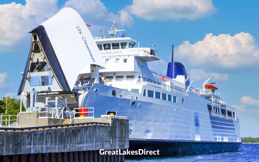
The Chi-Cheemaun ferry in Tobermory harbour
Tobermory on the Bruce Peninsula is connected to Manitoulin Island by the Chi-Cheemaun ferry service.
This passenger and vehicle ferry operates from the end of the first week in May through to mid-October and docks at the small port of South Baymouth, where Highway 6 recommences.
The ferry ride takes approximately 1 hour and 45 minutes to cross the 19 nautical miles (35 kilometers) between the two ports. There is one round trip service a day all summer long, with a second added in high season. Reservations are highly recommended!
If you know when you are planning to go but haven't decided on accommodation, then use the map below to get an idea of which properties are available and to compare prices during the period you wish to travel.
Enter your proposed dates and use the '+' to zoom in on a location and reveal more properties. Click on the price above a property to see more information.
(Please note that this selection will also include some vacation rentals for those who are interested in that form of accommodation!)
Alternatively, if you are looking for a list of properties available in Manitoulin Island you can check the accommodation listings on reservation platform Booking.com:
According to Anishinaabe legend, Manitoulin Island was created by the great spirit Kitchi-Manitou as a place of refuge for the people.
In fact, archaeological research indicates that Manitoulin Island has been inhabited by First Nations people for at least 10,000 years.
The Anishinaabe people, who include the Odawa, Ojibwe and Potawatomi nations, have a strong connection to the island and consider it a sacred place.
The first recorded European visit to Manitoulin Island was by French explorer Joseph Désy in 1648.
The British Crown and the Anishinaabe people signed a treaty in 1836 that established Manitoulin Island as a refuge for the indigenous people.
However, a new treaty in 1862 opened much of the island to European settlement, resulting in the displacement of many First Nation communities.
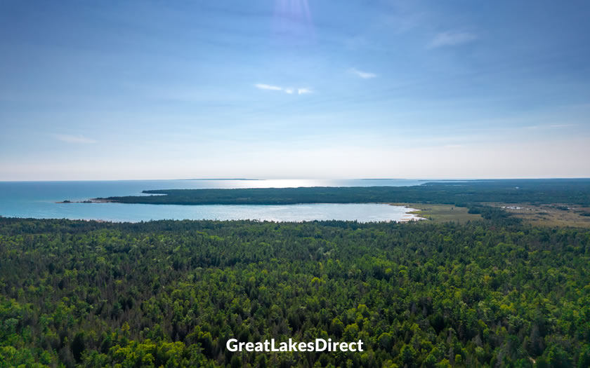
View over Misery Bay, Manitoulin Island
In the early 1900s, Manitoulin Island saw the growth of industries such as logging, fishing and agriculture.
The Little Current Swing Bridge was built in 1918, providing a permanent land connection between Manitoulin Island and the mainland.
The 1960s and 1970s brought a renewed focus on indigenous rights and cultural preservation on the island. Today, Manitoulin Island is home to six Anishinaabe First Nations communities: Wiikwemkoong, Sheguiandah, Aundeck Omni Kaning, M'Chigeeng, Sheshegwaning and Zhiibaahaasing.
Tourism, agriculture and small-scale manufacturing are the mainstays of the island's economy.
There are two incorporated towns on Manitoulin Island: (Northeastern Manitoulin and the Islands and Gore Bay). The port of South Baymouth is part of Tehkummah township, while Little Current (where the bridge is located) is part of Northeastern Manitoulin and the Islands.
Manitoulin Island features over 100 inland lakes, numerous hiking trails, and some unique geological features.
The Gore Bay Museum is located in the former jailer's house near the courthouse. It displays artifacts from the former settlers in the area and also houses exhibitions by local artists.
The series of waterfalls are located near the town of Kagawong, a small community on the north-central coast of Manitoulin Island.
The water empties from nearby Lake Kagawong. The main falls are around 35 feet (11 meters) high and cascade over a limestone cliff into the Kagawong River below.
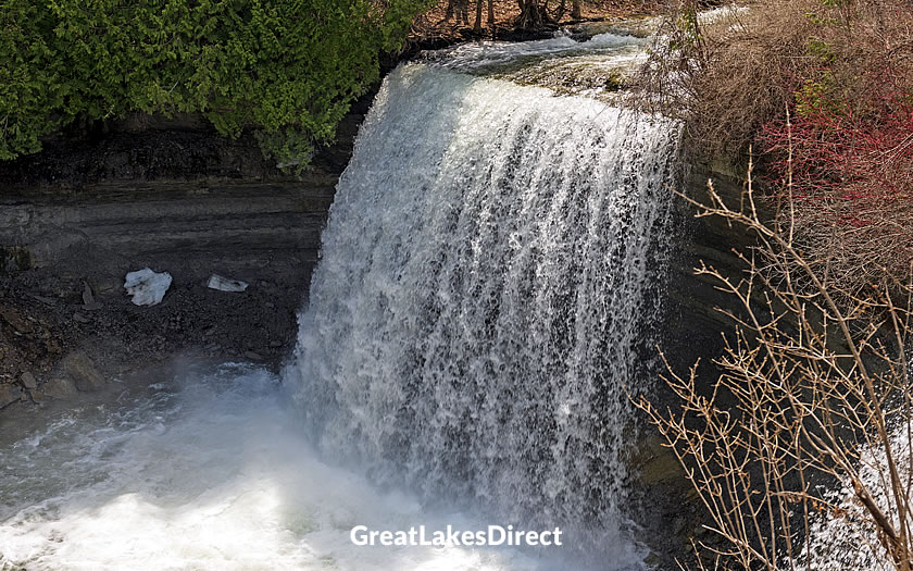
Bridal Veil Falls, Manitoulin Island
The falls are easily accessible via a short, well-maintained trail from the parking area. This leads to a viewing platform and a staircase that descends to the base of the falls.
The best time to visit Bridal Veil Falls is during the spring or early summer when water flow is at its highest.
The Cup and Saucer Trail is probably the most popular hiking trail on Manitoulin Island. Located in the Niagara Escarpment, a UNESCO World Biosphere Reserve, it is known for its stunning views and unique geological features.
It is named after the Cup and Saucer, a distinctive rock formation that resembles a cup and saucer when viewed from a certain angle.
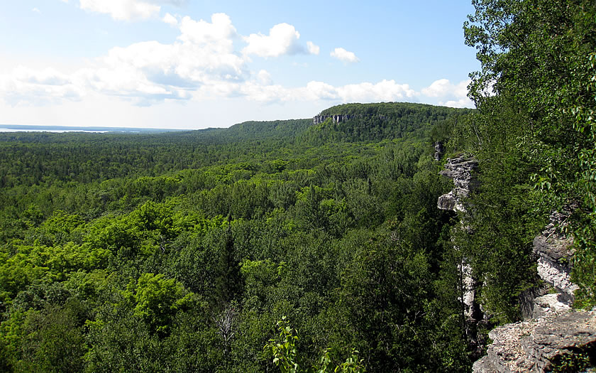
Cup and Saucer Trail, Manitoulin Island | Wikimedia: elPadawan
The trailhead is located on Highway 540, about 18 kilometers (11 miles) east of Little Current, the island's main town.
The route offers a series of lookout points that give panoramic views of the island, Lake Huron, and the surrounding countryside. The highest point on the trail is 351 meters (1,152 feet) above sea level.
The main trail is approximately 5 kilometers (3.1 miles) long and is considered a moderate to difficult hike, with some steep inclines and rocky sections.
There is a shorter, 2-kilometer (1.2-mile) loop called the Adventure Trail, which is suitable for less experienced hikers or those with limited time.
Hikers should come prepared with sturdy footwear, water, snacks, and weather-appropriate clothing, as the trail can be challenging in spots and weather conditions can change quickly.
Manitoulin Island offers a range of cultural tours and experiences that provide visitors with an opportunity to learn about the island's Indigenous heritage and connect with local Anishinaabe communities.
Wiikwemkoong Heritage Organization: This community-based organization offers guided tours of the Wiikwemkoong Unceded Territory, the largest Anishinaabe reserve on Manitoulin Island. Tours highlight local history, culture, and natural attractions, such as the Bebamikawe Memorial Trail and the Wiikwemkoong Islands.
The Unceded Journey
Ojibwe Cultural Foundation: Located in M'Chigeeng, this cultural center features exhibits on Anishinaabe history, art, and culture. Visitors can attend workshops and demonstrations, and purchase authentic Indigenous crafts and artwork.
Centennial Museum of Sheguiandah: This small museum and cultural center features exhibits on the history and culture of the Sheguiandah First Nation, one of the six Indigenous communities on Manitoulin Island. Visitors can learn about traditional Anishinaabe life, view archaeological artifacts, and hike nearby nature trails.
Note: the previously popular Great Spirit Circle Trail tour operator is no longer in operation.
Explore Manitoulin : www.exploremanitoulin.com
Gore Bay Museum : www.gorebaymuseum.com
Wikwemikong Tourism : wikytours.com