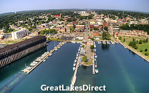
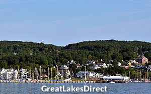
Munising is a small city located on the southern shore of Lake Superior, known as the gateway to the Pictured Rocks National Lakeshore.
This unique geological formation features colorful cliffs, waterfalls, and pristine beaches that attract visitors from around the world.
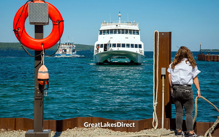
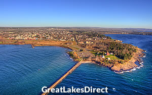
Passenger ferries in Munising
Munising is also close to Grand Island, a historic island offering hiking trails, beaches, and remnants of an old fishing village.
Munising is located in the central region of Michigan's Upper Peninsula, just over 40 miles east of Marquette and more than 120 miles west of Sault Ste Marie on the Canadian border and Mackinaw City on the Lower Peninsula.
It is the county seat of Alger County and has a population of around 2000 residents.
The Anna River runs through it to Munising Bay, between Munising Harbor and Grand Island, a popular spot for day trips on the regular ferries.
Marquette Sawyer Regional Airport is the closest airport to Munising. It is around 40 miles directly west of the city and offers daily connections to the large international airports at Chicago and Detroit.
The M-28 highway runs west along the shore through a junction with US-41 just before Marquette. After joining the M-94 for a short section it continues east from Munising through to Sault Ste Marie.
The M-94 highway runs west to Marquette Sawyer Regional Airport and south to Manistique on the Lake Michigan shore.
Different points along the Pictured Rocks National Lakeshore can be accessed via the county highway network.
If you know when you are planning to go but haven't decided on accommodation, then use the map below to get an idea of which properties are available and to compare prices during the period you wish to travel.
Enter your proposed dates and use the '+' to zoom in on a location and reveal more properties. Click on the price above a property to see more information.
(Please note that this selection will also include some vacation rentals for those who are interested in that form of accommodation!)
Alternatively, if you are looking for a list of properties available in Munising you can check the accommodation listings on reservation platform Booking.com:
The area's name, Munising, is derived from an Ojibwe word meaning "near the island," a nod to the nearby Grand Island in Lake Superior.
The 17th and 18th centuries introduced European explorers and fur traders to the region, but it wasn't until the mid-19th century that Munising began to develop as a community.
The establishment of permanent settlements coincided with an increased demand for natural resources, particularly timber, from the dense forests that surrounded the area.
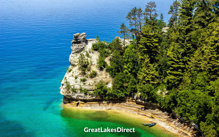
Miners Castle rock formation
By the late 1800s, Munising's economic landscape was dominated by the lumber industry. Its strategic location on the southern shore of Lake Superior enabled the thriving of sawmills and the shipping of lumber to other parts of the country.
The early and mid-20th century saw Munising evolve into a more varied economic hub, with tourism gradually becoming more important.
The establishment of the Pictured Rocks National Lakeshore in 1966 marked a significant shift towards embracing tourism and conservation. This designation protected the area's unique sandstone cliffs, waterfalls, and beaches, drawing visitors from around the world.
Today, Munising is known for its natural beauty and outdoor recreational opportunities, including hiking, kayaking, and sightseeing.
Visitor information in Munising can be found at:
Plans for a National Park were originally drawn up in the late 1950s, but it was not until 1966 that the necessary legislation for Pictured Rocks National Lakeshore came into effect.
The 42 miles of shore covers the area between Munising and Grand Marais (not to be confused with the Grand Marais in Minnesota). The park attracts just under a million visitors each year.
Pictured Rocks National Lakeshore takes its name from the mineral-rich sandstone cliffs that rise up to 200 feet above Lake Superior.
Over time, water, ice, and wind have sculpted the sandstone into a variety of shapes and formations. These cliffs are painted in shades of ochre, tan, and green, created by the leaching of iron, copper, and other minerals.
Notable formations include Miners Castle, Chapel Rock, and the Grand Portal Arch.
Five reasons to visit Pictured Rocks from the National Park Service
Away from the rocks, the park offers more than 100 miles of hiking trails through forests of maples, birches, and evergreens, leading to secluded beaches, crystal clear streams, and more than a dozen waterfalls. This is a habitat for a wide variety of wildlife, including black bears, moose, and over 100 species of birds.
Hiking trails such as the Chapel Loop and the Lakeshore Trail provide access to remote lakes, waterfalls, and scenic overlooks. The North Country Trail, a national scenic trail stretching from North Dakota to New York, passes through the lakeshore and offers long-distance hiking opportunities.
Kayaking along the lake's shoreline gives visitors a unique perspective of the cliffs, sea caves, and rock formations.
Those who prefer to avoid the exertion of kayaking and take a commercial Pictured Rocks cruise from Munising.
Human history in the area dates back thousands of years, from early Native American inhabitants to European fur traders and loggers.
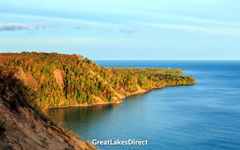
Au Sable Point near Pictured Rocks
The park preserves several historical sites, including Au Sable Light Station, which guided mariners along Lake Superior's treacherous shores since the late 19th century.
Pictured Rocks National Lakeshore is one of the main attractions for those on the Lake Superior Circle Tour.
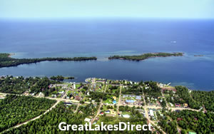
Grand Island is located just off the coast of Munising, roughly half a mile from the mainland. It is part of the Hiawatha National Forest and is designated as the Grand Island National Recreation Area.
There is evidence of human occupation dating back over 3,000 years. Native American tribes, such as the Chippewa and Ojibwa, utilized the island for fishing, hunting, and gathering.
Later European settlers used the island for logging, fishing, and as a recreational retreat. Historical artifacts, old cemeteries, and remnants of past settlements are scattered throughout the island
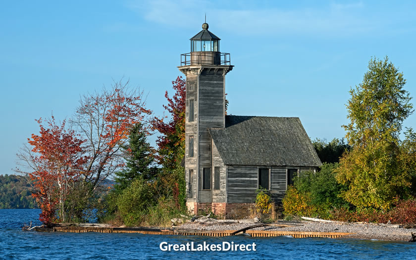
Grand Island East Channel Lighthouse
Access to Grand Island is primarily via passenger ferry or private boat from Munising. The island operates seasonally, with the ferry running from approximately late May to early October.
There are several rustic campgrounds and individual backcountry campsites scattered throughout the island, allowing for overnight stays in a primitive setting. Day visitors can also enjoy picnic areas and beaches.
There are 17 different waterfalls in the Munising area. Some of them, such as Bridal Veil falls, tumble into Lake Superior in the Pictured Rocks national park, while others are just a short trip from Munising itself.
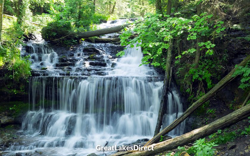
Wagner Falls near Munising
Munising Falls, for example, is a 50-foot waterfall within the city limits, near Munising Memorial Hospital. It is accessible along a paved trail via Munising Creek.
The much-photographed Wagner Falls is a series of smaller cascades. It is located around two miles outside Munising and has a small pull-off for cars before the short walk up to the falls.
Marquette is the largest city in Michigan's Upper Peninsula and is known for its stunning natural beauty and outdoor recreational opportunities. The city is home to Northern Michigan University and boasts a lively downtown area. Marquette's Presque Isle Park offers breathtaking views of Lake Superior and features hiking trails, beaches, and a historic lighthouse.
Copper Harbor is a small, picturesque town located at the northern tip of Michigan's Keweenaw Peninsula, known for its stunning natural beauty and rich mining history. Today, Copper Harbor is a popular destination for outdoor enthusiasts, offering world-class mountain biking trails, hiking, and scenic drives along the Brockway Mountain Drive.
Bayfield is a small city on the Wisconsin shore known as the "Gateway to the Apostle Islands", a group of 22 islands featuring pristine beaches, lighthouses, and sea caves. Bayfield is also famous for its annual Apple Festival, which features live music, arts and crafts as well as apple-themed treats.
Two Harbors is a port town located on Minnesota's North Shore of Lake Superior. The town is not far from the historic Split Rock Lighthouse, built in 1910 and offering stunning views of the lake. The Two Harbors area is also known for its unique geologic features, including the Gooseberry Falls State Park and the ancient lava flows at Palisade Head.
Munising Visitors Bureau : www.munising.org
Alger County Chamber of Commerce : algercountychamber.com
National Park Service - Pictured Rocks : www.nps.gov
US Forest Service - Grand Island : www.fs.usda.gov